![](/images/other/stat-length.png)
![Randonnée A pied San Godenzo - Per andare a Monte dei Gralli - Photo](https://media.geolcdn.com/t/1900/400/1f6e5650-a3e2-484e-afab-09dd2e4a17cf.jpeg&format=pjpeg&maxdim=2)
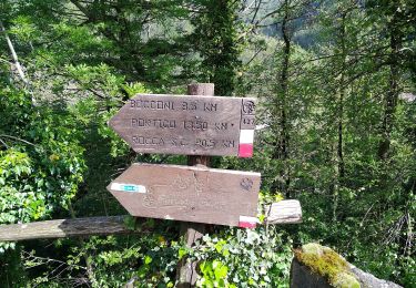
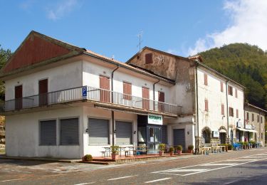
Per andare a Monte dei Gralli
SityTrail - itinéraires balisés pédestres
Tous les sentiers balisés d’Europe GUIDE+
![Longueur](/images/other/stat-length.png)
Longueur
12,2 km
![Altitude max](https://static1.geolcdn.com/siteimages/upload/files/1508320355ic_sort_altitude_max_24dp.png)
Altitude max
1052 m
![Dénivelé positif](https://static1.geolcdn.com/siteimages/upload/files/1508320355ic_sort_den_pos_24dp.png)
Dénivelé positif
446 m
![Km-Effort](/images/other/stat-length.png)
Km-Effort
18,3 km
![Altitude min](https://static1.geolcdn.com/siteimages/upload/files/1508320355ic_sort_altitude_min_24dp.png)
Altitude min
732 m
![Dénivelé négatif](https://static1.geolcdn.com/siteimages/upload/files/1508320355ic_sort_den_neg_24dp.png)
Dénivelé négatif
463 m
![Boucle](https://static1.geolcdn.com/siteimages/upload/files/16400158638029165_repeat_loop_refresh_sync_direction_icon.png)
Boucle
Oui
Balise
Date de création :
2022-02-15 17:49:15.78
Dernière modification :
2022-03-01 21:50:16.701
![A pied](https://static1.geolcdn.com/sitytour/trail-icons/100.png)
4h08
Difficulté : Facile
![Scannez ce code QR pour ouvrir la randonnée dans l'application SityTrail](https://capi.geolives.com/qq0zvz2zws4bq2lad0pu/sitytour/trails/3122936/qr.png?size=200)
Application GPS de randonnée GRATUITE
À propos
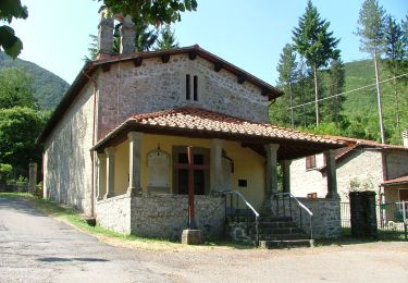
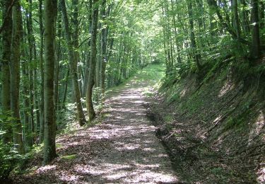
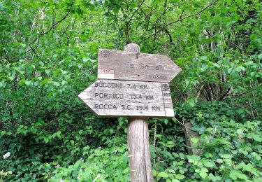
Randonnée A pied de 12,2 km à découvrir à Toscane, Firenze, San Godenzo. Cette randonnée est proposée par SityTrail - itinéraires balisés pédestres.
Description
Randonnée créée par Parco Nazionale Foreste Casentinesi.
Localisation
Pays :
Italie
Région :
Toscane
Département/Province :
Firenze
Commune :
San Godenzo
Localité :
Unknown
Départ:(Dec)
Départ:(UTM)
712257 ; 4868785 (32T) N.
Commentaires
Randonnées à proximité
![Randonnée A pied San Godenzo - Sogenti di Firenze Trekking - Anello Principale - Photo](https://media.geolcdn.com/t/375/260/130d3e21-ebaa-4aab-ad63-5ee7456f7c76.jpeg&format=jpg&maxdim=2)
![A pied A pied](https://static1.geolcdn.com/sitytour/trail-icons/100.png)
Sogenti di Firenze Trekking - Anello Principale
A pied
Très difficile
San Godenzo,
Toscane,
Firenze,
Italie
![](/images/other/stat-length.png)
209 km | 333 km-effort
75h 46min
![](https://static1.geolcdn.com/siteimages/upload/files/16400158638029165_repeat_loop_refresh_sync_direction_icon.png)
Oui
![Randonnée A pied San Godenzo - Sorgenti di Firenze Trekking – Anello Principale: Tappa 3 - Photo](https://media.geolcdn.com/t/375/260/9cb41ace-b4d3-4e53-b2a8-2ef3b3fa315c.jpeg&format=jpg&maxdim=2)
![A pied A pied](https://static1.geolcdn.com/sitytour/trail-icons/100.png)
Sorgenti di Firenze Trekking – Anello Principale: Tappa 3
A pied
Facile
San Godenzo,
Toscane,
Firenze,
Italie
![](/images/other/stat-length.png)
11,6 km | 17,9 km-effort
4h 4min
![](https://static1.geolcdn.com/siteimages/upload/files/16400158638029165_repeat_loop_refresh_sync_direction_icon.png)
Non
![Randonnée A pied Portico e San Benedetto - Un grande anello sopra a Castel dell’Alpe - Photo](https://media.geolcdn.com/t/375/260/0fa289ca-7c51-4ac9-85e8-89b1f300995c.jpeg&format=jpg&maxdim=2)
![A pied A pied](https://static1.geolcdn.com/sitytour/trail-icons/100.png)
Un grande anello sopra a Castel dell’Alpe
A pied
Moyen
Portico e San Benedetto,
Émilie-Romagne,
Forlì-Cesena,
Italie
![](/images/other/stat-length.png)
14,5 km | 23 km-effort
5h 12min
![](https://static1.geolcdn.com/siteimages/upload/files/16400158638029165_repeat_loop_refresh_sync_direction_icon.png)
Oui
![Randonnée A pied Portico e San Benedetto - L’anello classico dell’Acquacheta - Photo](https://media.geolcdn.com/t/375/260/e0e65af1-b08c-4714-9518-f040c77653ce.jpeg&format=jpg&maxdim=2)
![A pied A pied](https://static1.geolcdn.com/sitytour/trail-icons/100.png)
L’anello classico dell’Acquacheta
A pied
Facile
Portico e San Benedetto,
Émilie-Romagne,
Forlì-Cesena,
Italie
![](/images/other/stat-length.png)
10,3 km | 17,1 km-effort
3h 53min
![](https://static1.geolcdn.com/siteimages/upload/files/16400158638029165_repeat_loop_refresh_sync_direction_icon.png)
Oui
![Randonnée A pied San Godenzo - Il Falterona e la Foresta di Campigna - Photo](https://media.geolcdn.com/t/375/260/f301653d-c372-4fde-82f6-7ea9079c2ad5.jpeg&format=jpg&maxdim=2)
![A pied A pied](https://static1.geolcdn.com/sitytour/trail-icons/100.png)
Il Falterona e la Foresta di Campigna
A pied
Très difficile
San Godenzo,
Toscane,
Firenze,
Italie
![](/images/other/stat-length.png)
33 km | 57 km-effort
12h 51min
![](https://static1.geolcdn.com/siteimages/upload/files/16400158638029165_repeat_loop_refresh_sync_direction_icon.png)
Non
![Randonnée A pied San Godenzo - (SI L07) Passo del Muraglione - Passo della Colla di Casaglia - Photo](https://media.geolcdn.com/t/375/260/5dc2f472-a2d0-4211-86b0-20d06b5f739a.jpeg&format=jpg&maxdim=2)
![A pied A pied](https://static1.geolcdn.com/sitytour/trail-icons/100.png)
(SI L07) Passo del Muraglione - Passo della Colla di Casaglia
A pied
Difficile
San Godenzo,
Toscane,
Firenze,
Italie
![](/images/other/stat-length.png)
24 km | 36 km-effort
8h 5min
![](https://static1.geolcdn.com/siteimages/upload/files/16400158638029165_repeat_loop_refresh_sync_direction_icon.png)
Non
![Randonnée A pied San Godenzo - Cascata di Calabuia - Photo](https://media.geolcdn.com/t/375/260/2bc3a502-37c6-4fde-b9d0-b85c41bb8634.jpeg&format=jpg&maxdim=2)
![A pied A pied](https://static1.geolcdn.com/sitytour/trail-icons/100.png)
Cascata di Calabuia
A pied
Facile
San Godenzo,
Toscane,
Firenze,
Italie
![](/images/other/stat-length.png)
4,4 km | 9,5 km-effort
2h 9min
![](https://static1.geolcdn.com/siteimages/upload/files/16400158638029165_repeat_loop_refresh_sync_direction_icon.png)
Non
![Randonnée A pied Portico e San Benedetto - IT-427 - Photo](https://media.geolcdn.com/t/375/260/c8ebfc66-ef46-49ea-beb1-6eb8f9fabe57.jpeg&format=jpg&maxdim=2)
![A pied A pied](https://static1.geolcdn.com/sitytour/trail-icons/100.png)
IT-427
A pied
Moyen
Portico e San Benedetto,
Émilie-Romagne,
Forlì-Cesena,
Italie
![](/images/other/stat-length.png)
14,9 km | 22 km-effort
4h 58min
![](https://static1.geolcdn.com/siteimages/upload/files/16400158638029165_repeat_loop_refresh_sync_direction_icon.png)
Non
![Randonnée A pied San Godenzo - IT-4 - Photo](https://media.geolcdn.com/t/375/260/e9201934-1504-4de1-90ca-58ff0ff3313b.jpeg&format=jpg&maxdim=2)
![A pied A pied](https://static1.geolcdn.com/sitytour/trail-icons/100.png)